Parkway Properties
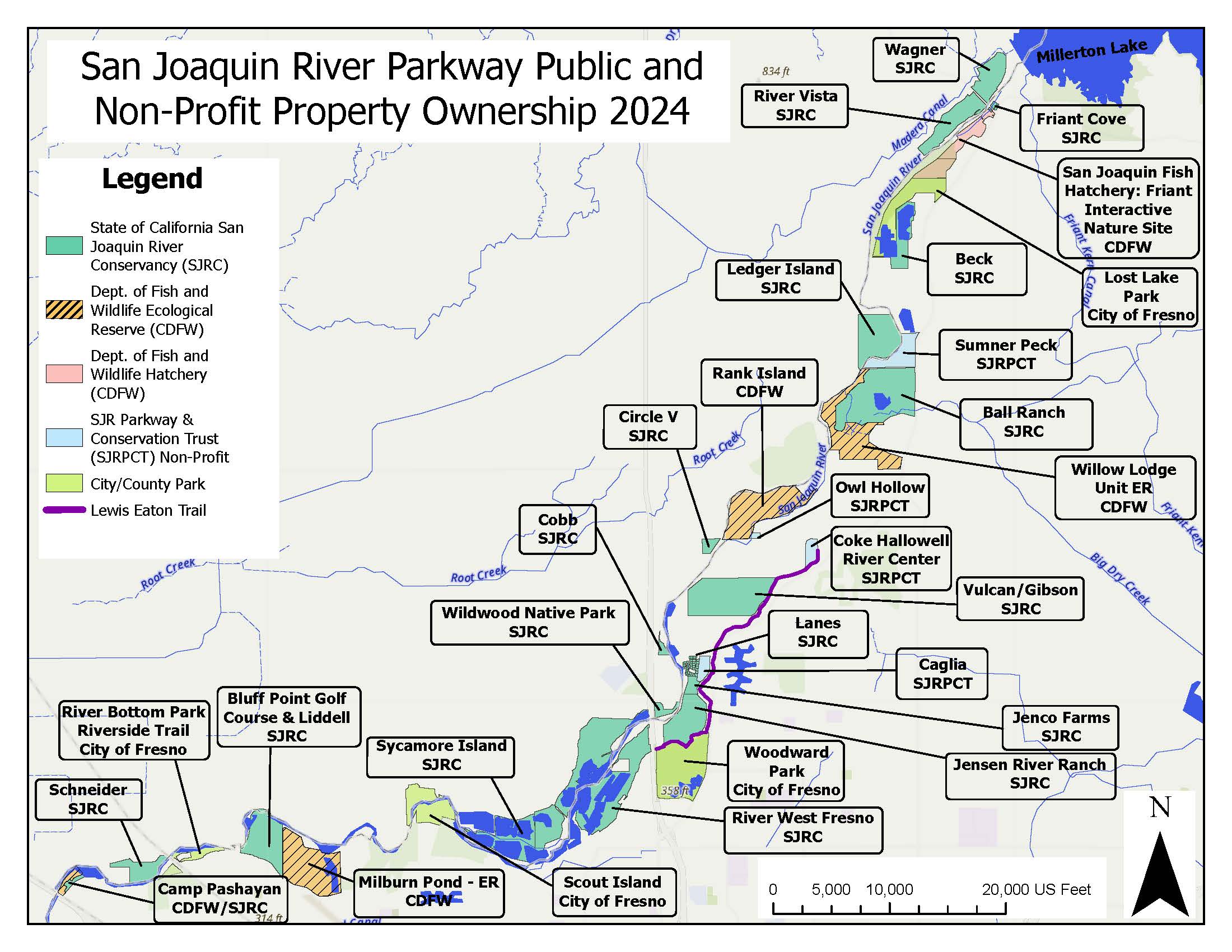
The following properties are open for public recreation. They are in order geographically starting at Friant Dam and ending at Highway 99.
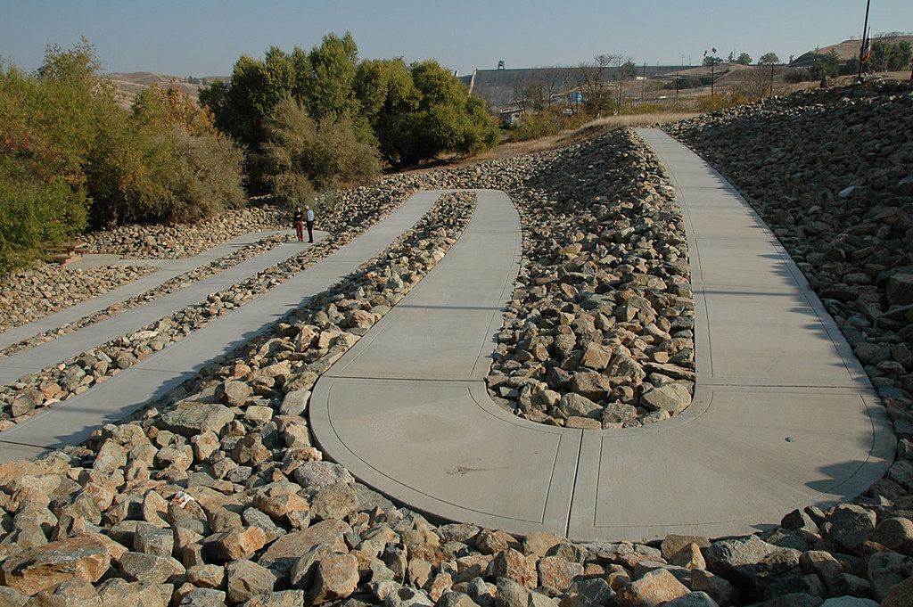
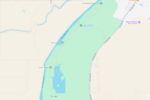
Friant Cove - San Joaquin River Conservancy
Property Description:
Located at the intersection of Millerton and North Fork roads in Friant. Friant Cove was purchased by the Conservancy in 1996. The Conservancy secured two grants to acquire the property and construct a park and ride facility, a non-motorized small boat launch, restrooms, interpretive displays and signage on the approximately six-acre site. Improvements began in 2001 and opened in October 2007.
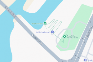
Click the map above for directions to Friant Cove.
Amenities:
Onsite amenities include accessible restrooms, park and ride, paved accessible path to riverbed, picnic tables, and river access with hand-carried kayak/canoe launch.
Open Daily, Seasonal Hours:
January, February 6:00 a.m. – 6:00p.m.
March 6:00 a.m.-7:00 p.m.
April, May, June, July, August, September 6:00 a.m.-10:00 p.m.
October 6:00 a.m.-7:00 p.m.
November, December 6:00 a.m. – 6:00 p.m.
Fees:
None.
Operations and Maintenance:
Friant Cove is operated by Millerton Lake State Recreation Area. For more information please contact (559) 822-2332.
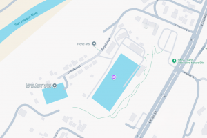
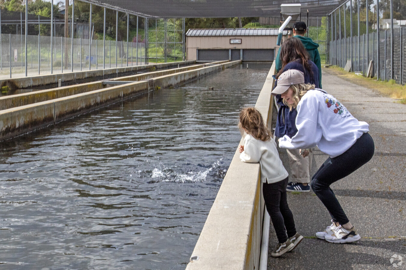
FINS and the San Joaquin Hatchery - Department of Fish and Wildlife
Property Description:
The Friant Interactive Nature Site (FINS) includes the San Joaquin Trout and Salmon Hatcheries, the Small Fry Trail, a children’s exploratory trail, and section of the Parkway Trail, California native vegetation, wildlife viewing, and connection to the neighboring Fresno County Lost Lake Park. Follow this link to the FINS main page.
Click the map above for directions to FINS.
Amenities:
Onsite amenities include accessible restrooms, bus and auto parking, paved accessible paths, picnic tables, and an outdoor amphitheater.
Open Daily:
7:30 a.m. – 3:00 p.m.
Fees:
None.
Operations and Maintenance:
The San Joaquin Hatchery is owned and operated by the Department of Fish and Wildlife. For more information, please contact (559) 822-2374.
Lost Lake Recreation Area - County of Fresno
Property Description:
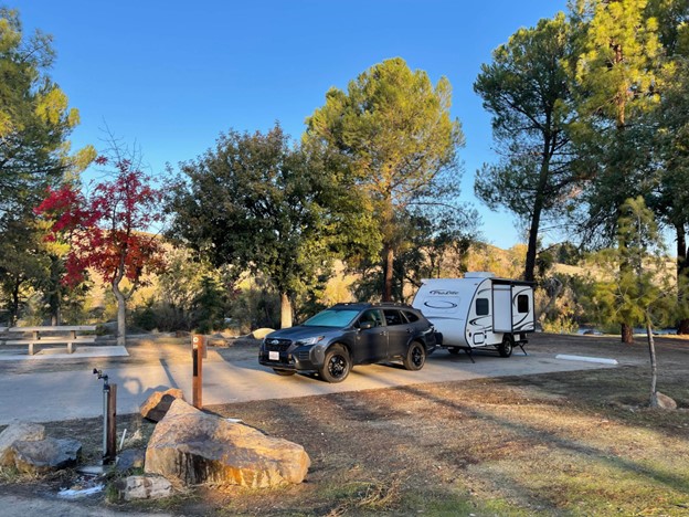
In 1956, the County of Fresno purchased 248 acres from the Bureau of Land Management to create Lost Lake Recreation Area. In 1959, the County of Fresno leased an additional 78 acres from the State of California State Wildlife Conservation Board to expand the fishing and day use area and bring the total acreage to 326 acres. On March 26,1961, Lost Lake Recreation Area was dedicated and formally open to the public. Originally a fishing and day use area, the campground planning began in 1974 however construction did not begin until 1980. In 1981, at a cost of $462,000, The Campground at Lost Lake Recreation Area opened to the public.
The Campground at Lost Lake Recreation Area was closed in September 2014 for improvements and upgrades. A $1.4 million grant was provided by the Wildlife Conservation Board utilizing Prop 40 funds via recommendations from the San Joaquin River Conservancy. The project came in under budget by approximately $150,000 and the County of Fresno contributed over $100,000 of in-kind labor and materials. Follow this link to the Lost Lake main page.
Click the map above for directions to Lost Lake Recreation Area
Amenities:
Lost Lake provides camping, fishing, play areas, bird watching, picnic tables, and a stabilized boat launch for river access.
The Campground at Lost Lake Recreation Area provides for tent, auto, and motorhome camping with river views. Each of the 37 campsites have picnic tables and campfire rings. Water and restrooms are provided adjacent to the campsites. Each campsite is accessible for vehicles up to 34′ long. They feature two ADA compliant campsites that are reserved for people with disabilities.
Open Daily, Seasonal Hours:
January, February, March 7:00 a.m. – 7:00 p.m.
April, June, July, August, September 7:00 a.m. – 10:00 p.m.
October, November, December 7:00 a.m. 7:00 p.m.
*When campground is open, all campers must check-in prior to close of park.
Fees:
$5.00 per vehicle
** See Lost Lake main page for camping rates and annual passes.
Operations and Maintenance:
Lost Lake Recreation Area is owned and operated by the County of Fresno. For more information and camping reservations please contact (559) 600-3004.
Sumner Peck - River Parkway Trust
Property Description:
In 2020, the 76-acre ranch was purchased by the River Parkway Trust, with funding provided through SJRC. The ranch, with existing developed vehicular access off Friant Road, is a lynchpin parcel between the Ball Ranch and Ledger Island. While generally developed for agricultural purposes, the property does include a riparian zone along the river. Though currently operating as a farm and special event venue in the short term (3-5 years), the River Parkway Trust’s publicly stated long-term plans include restoring the site to wildlife habitat for the public benefit. The property includes a half-mile of river frontage and wildlife habitat in addition to farmland. Follow this link to the Sumner Peck main page.
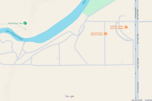
Click the map above for directions to Sumner Peck
Amenities:
Primitive trails and parking areas, portable restrooms throughout, pedestrian river access and seasonal fruit picking.
Open Daily:
12:00 p.m. – 5:00 p.m.
Fees:
None.
**Seasonal U-pick fruits available for purchase.
Operations and Maintenance:
Sumner Peck is owned and operated by the San Joaquin River Parkway and Conservation Trust. For more information please contact (559) 248-8480.
Ball Ranch and Ledger Island - San Joaquin River Conservancy
Property Description:
Ball Ranch is located on Friant Road north of Willow Ave. Ledger Island is accessible via canoe or kayak from the river or by trail on the Madera side through Tesoro Viejo. The bridge between Ball Ranch and Ledger Island is closed for all crossing.
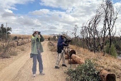
Enjoy the 142-foot-by-35-foot log egret maze, designed by Conservancy Staff built by and for the community, located adjacent to the main parking lot. Horseback riding, shore fishing on the ponds, mountain biking, nature walks and wildlife viewing and appreciation.
Click the map above for directions to Ball Ranch.
Amenities:
A visitor center with snacks, drinks, and tackle available for purchase and restrooms throughout the park. Primitive parking lot allows access for vehicles, and vehicles with trailers.
Open Daily, Seasonal Hours:
January, February March 6:00 a.m. – 5:30 p.m.
April 6:00 a.m. – 7:00 p.m.
May, June, July, August 6:00 a.m. – 8:30 p.m.
September 6:00 a.m. – 7:00 p.m.
October, November, December 6:00 a.m. – 5:30 p.m.
Fees:
None.
Operations and Maintenance:
Ball Ranch and Ledger Island are owned by the San Joaquin River Conservancy and operated by the San Joaquin River Parkway and Conservation Trust. For more information please contact (559) 248-8480.
Ledger Island Bridge - PERMANENT CLOSURE NOTICE
Ledger Island Safety Notice – PERMANENT BRIDGE CLOSURE
The San Joaquin River Conservancy, through a State Lands Commission lease, is responsible for the maintenance of an existing road right of way, bridge crossing, approach embankments, and associated riprap bank protection located near River Mile 262.2 on the San Joaquin River. The leased area, known as the Ledger Island Bridge, was built as a crossing between Conservancy owned properties in Fresno and Madera County, currently known as Ball Ranch and Ledger Island. The San Joaquin River Parkway and Conservation Trust (River Parkway Trust) is the current operation and maintenance agreement holder for Ball Ranch and Ledger Island.
In 2014, the Department of Water Resources (DWR) began gathering information on the Ledger Island Bridge for planning purposes. During this early evaluation, DWR advised that a complete structural evaluation be performed prior to considering any design work.
DWR concluded that the bridge foundation piles are inadequate to safely carry vehicles or pedestrians due to excessive scour. A buckling failure in the pile foundation of the center pier, combined with the simple span design of the superstructure, can lead to a sudden and catastrophic failure without advance warning. Therefore, DWR recommended the bridge not be used for any purpose until steps are taken to remediate the effects of scour on the foundations, or until the existing structure is replaced. Since the survey completed in 2014 there have been multiple high-water events and further visible degradation to the pier, abutments and wings.
The San Joaquin River Conservancy has permanently closed the bridge and surrounding area between Ledger Island and Ball Ranch for any and all types of crossings (e.g. pedestrian, vehicle, etc.). Barriers and signage have been installed at both ends of the bridge advising the recreating public of the bridge closure due to the unsafe nature of the bridge.
Coke Hallowell Center for River Studies - River Parkway Trust
Coke Hallowell Center for River Studies, owned and operated by the San Joaquin River Parkway and Conservation Trust, is located at 11605 Old Friant Road, Fresno, CA. Click here for a map to the River Center. The River Center provides exhibits, a gift shop, gardens, seasonal nature walks, and canoe trips. Restrooms, a drinking fountain, Historic Ranch House, Hidden Homes Nature Trail, and the northerly terminus of the Lewis S. Eaton Trail are also on the grounds. The River Center hours are as follows: grounds are open daily, 8 a.m. – 5 p.m.; the Historic Ranch House is open weekends, 10 a.m. – 3 p.m.; and the Hidden Homes Nature Trail is open weekends, 10 a.m. – 3 p.m.; and weekdays, 8 a.m. – 4 p.m. For more information, visit the San Joaquin River Parkway and Conservation Trust website or call (559) 248-8480.
Lewis S. Eaton Trial - City of Fresno
Lewis S. Eaton Trail is operated by the City of Fresno and open daily, 6 a.m. – 10 p.m., April – October, and 6 a.m. – 7 p.m., November – March. The trail’s southerly terminus is located at Highway 41; the northerly terminus is located at the Coke Hallowell Center for River Studies. Trailhead parking for vehicles and horse trailers is provided inside Woodward Park for a $5 vehicle entry fee, and free parking is provided at the Coke Hallowell Center for River Studies. Additional points accessible by foot or bicycle along N. Friant Road are located at the intersections of E. Audubon Drive, Fort Washington Road, and E. Champlain Drive. Trailhead parking is available at E. Copper Avenue. A spur trail at the E. Copper Avenue access point connects to Copper River Ranch. Click here for a map to the Lewis S. Eaton Trail. Currently 4 miles long, the trail provides convenient access for walking, running, cycling, horseback riding, and nature observation along the bluffs of the San Joaquin River. Some portions of the trail have appropriate slopes for wheelchair access. For additional information, contact the City of Fresno, PARCS Department at (559) 621-2900.
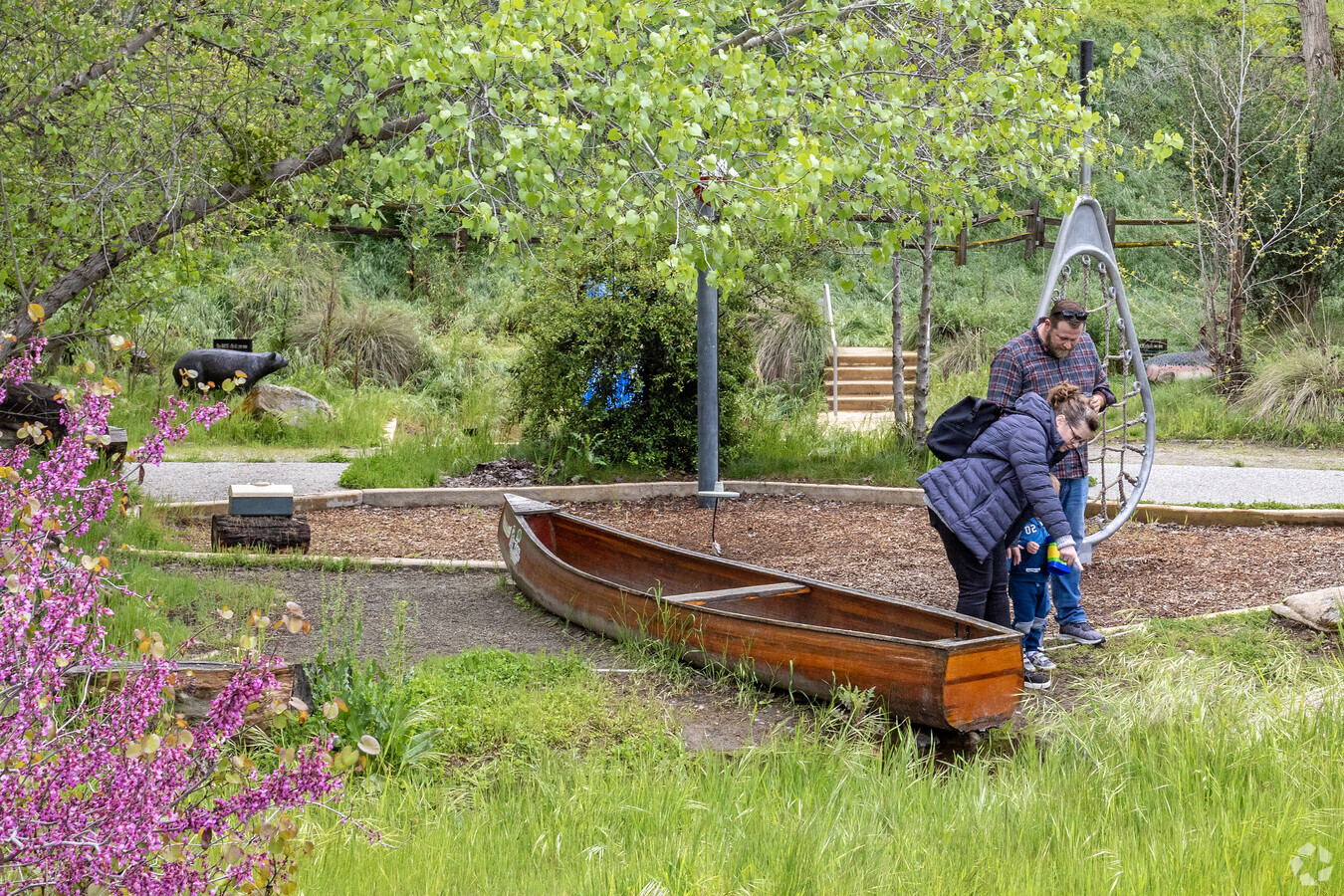
Jensen River Ranch and Tom MacMichael Sr. Trail - San Joaquin River Conservancy
Jensen River Ranch and the Tom MacMichael Sr. Trail are owned by the Conservancy and operated by the City of Fresno with assistance from the San Joaquin River Parkway and Conservation Trust. Jensen River Ranch is located on the San Joaquin River in Fresno, adjacent to Woodward Park and visible from Highway 41 and N. Friant Road. Diverse floodplain habitats are being restored on the 150-acre site. The MacMichael Trail is a 1.5-mile hiking trail designed for walkers, runners, bikers, and equestrians. Half of the trail is paved and provides Americans with Disabilities Act (ADA) access. Click here for a map to Jensen River Ranch and the Tom MacMichael Sr. Trail. You can access Jensen River Ranch on foot, by bicycle, or on horseback from the Lewis S. Eaton Trail or Woodward Park. Jensen River Ranch and the MacMichael Trail are open daily, 6 a.m. – 10 p.m., April – October, and 6 a.m. – 7 p.m., November – March. There is a $5 vehicle entry fee to park in Woodward Park. For more information, contact the Conservancy at (559) 253-7324.
Pathways of Our Ancestors - San Joaquin River Conservancy
Pathways of Our Ancestors is a Native American Garden owned by the Conservancy and maintained by Many Lightnings American Indian Legacy Foundation. The garden, showcasing local indigenous culture, is located at Jensen River Ranch (described above), on the west side of the property adjacent to the San Joaquin River. All of the plants in the garden, including oak trees, elderberry, deer grass, native grapes, and sage have a medicinal, food, or ceremonial purpose. The garden can be accessed on foot or by bicycle from the Tom MacMichael Sr. Trail (described above). Click here for a map to the Native American garden. For more information, contact the Conservancy.
Woodward Park - City of Fresno
Woodward Park, owned and operated by the City of Fresno, is located at 7775 N. Friant Road, Fresno, CA. Click here for a map to Woodward Park. The park offers restrooms, picnic sites with barbecues, several ponds and streams, the Shin Zen Friendship Garden, three playgrounds, the Art of Life Garden, and access to the Lewis S. Eaton Trail and Jensen River Ranch. The park is open daily, 6 a.m. – 10 p.m., April – October, and 6 a.m. – 7 p.m., November – March. There is a $5 fee for vehicles to enter the park. For more information, visit the City of Fresno, PARCS Department website or call (559) 621-2900.
Wildwood Native Park - San Joaquin River Conservancy
OPEN JANUARY 10, 2025! Wildwood Native Park is owned and operated by the Conservancy. Wildwood Native Park offers 22-acres of opportunities for low impact recreational activities including launch access to the San Joaquin River, fishing, picnicking, walking trails, and wildlife viewing and appreciation
Onsite amenities include restrooms, picnic tables, and a short, paved trail. Located along the banks of the San Joaquin River, east of Highway 41. Click here for a map to Wildwood Native Park. For more information, contact the Conservancy.
Open Daily, Seasonal Hours:
January, February March 6:00 a.m. – 5:30 p.m.
April 6:00 a.m.-7:00 p.m.
May, June, July, August 6:00 a.m.-8:30 p.m.
September 6:00 a.m.-7:00 p.m.
October, November, December 6:00 a.m. – 5:30 p.m.
Sycamore Island - San Joaquin River Conservancy
OPEN JANUARY 10, 2025! Sycamore Island, owned by the Conservancy and operated by the San Joaquin River Parkway and Conservation Trust, is a 600-acre natural area with river access and multiple ponds conveniently located in Madera near Valley Children’s Hospital along the San Joaquin River. Click here for a map to Sycamore Island. Sycamore Island is home to a variety of fish: bass, trout, catfish, blue gill and crappie, and is open to anglers of all ages, fishing license and fishing regulations apply. Visitors can also enjoy canoeing, picnicking, and walking trails or cycling to enjoy nature and observe wildlife. Equestrians may also utilize the trails. The site provides a number of stabilized boat launches to access various ponds and the San Joaquin River.
The entry fee is $9.00 per vehicle and $5.00 per horse or boat trailer (no gas-powered motors allowed). For more information, please visit the Sycamore Island Facebook page or call (559) 801-8690.
Open Daily, Seasonal Hours:
January, February March 6:00 a.m. – 5:30 p.m.
April 6:00 a.m.-7:00 p.m.
May, June, July, August 6:00 a.m.-8:30 p.m.
September 6:00 a.m.-7:00 p.m.
October, November, December 6:00 a.m. – 5:30 p.m
Scout Island - Fresno County Office of Education
Scout Island, owned and operated by the Fresno County Office of Education, is located on a gated, private road at 7695 N. Van Ness Avenue, Fresno, CA. Click here for a map to Scout Island. Scout Island offers field trips year-round to school groups and educational organizations to explore the San Joaquin River watershed, geology, flora, fauna, and cultural history. For additional information on programs and fees, visit the Scout Island website or call (559) 265-4062. For information on River Camp at Scout Island, visit the San Joaquin River Parkway and Conservation Trust website or call (559) 248-8480 ext. 107.
Bluff Pointe Golf Course and Learning Center at Liddell - San Joaquin River Conservancy
Bluff Pointe Golf Course and Learning Center is a privately operated, a beautiful 9-hole golf course located on the banks of the river and driving range, open seven days a week, 7 a.m. – 8 p.m. The operator leases Conservancy land on the river at Milburn Avenue in Fresno. Click here for a map. Call (559) 275-0600 or visit the Bluff Pointe Golf Course and Learning Center website for additional information.
Riverside’s Eaton Trail - City of Fresno
Riverside Trail is approximately one-mile long and is owned and operated by the City of Fresno. The trail is accessible from the Riverside Golf Course parking lot in Fresno. Click here for a map to the Riverside Trail. The steep, paved trail descends to the river bottom, where visitors can enjoy a sandy beach at the river’s edge. For more information, contact the City of Fresno, PARCS Department at (559) 621-2900.
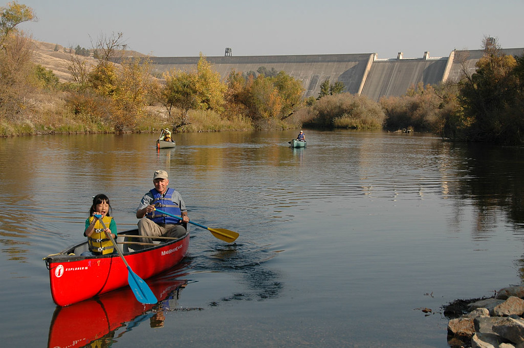
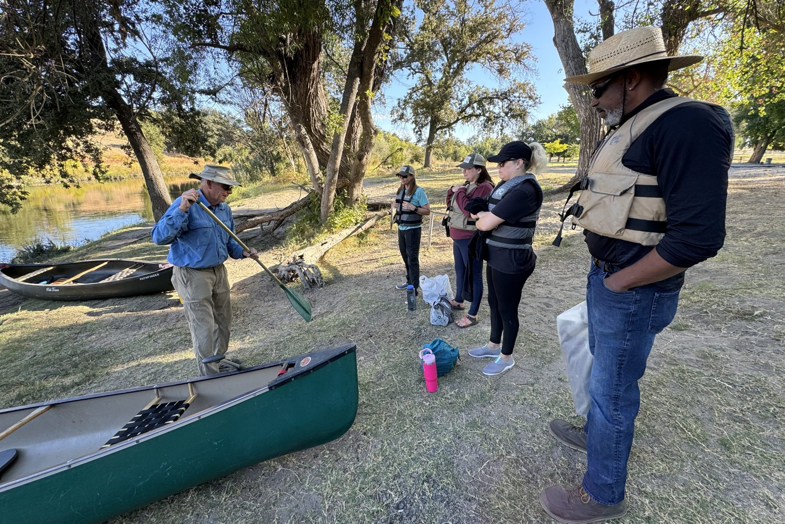
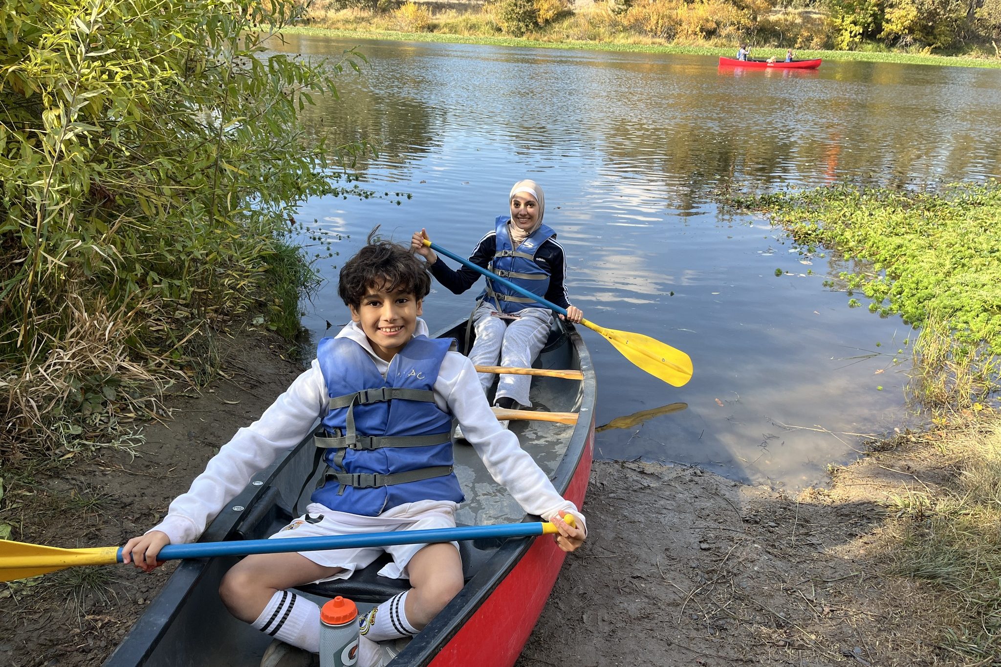
Paddling the River
Visitors to the San Joaquin River Parkway may paddle the river by canoe, kayak, and paddleboard, provided they launch and take out at launch sites open to the public, such as those at Friant Cove, Lost Lake Park, Fort Washington Beach (privately operated), Sycamore Island, and Sumner Peck. On-the-water travel time between these launches can be 4 hours or more. Use proper floatation devices. Beware of high flows, shallow side channels, obstructions, and snags. Paddlers inexperienced on this reach of the San Joaquin River should paddle first with well-experienced guides.